Coming up: A landslide map of India
-
- from Shaastra :: vol 03 issue 01 :: Jan - Feb 2024
A nationwide early warning system for landslides is in the works.
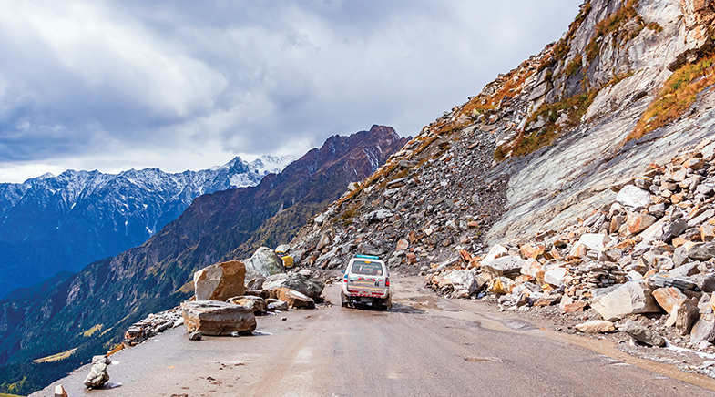
Nirdesh Sharma hails from Himachal Pradesh, where landslides are a way of life, disrupting school, blocking roads, making the higher reaches inaccessible for days, and killing people. For his doctorate at IIT Delhi, therefore, he wanted to map India’s landslide susceptibility.
Sharma’s mentor Manabendra Saharia, who heads the institute’s HydroSense Lab and is primarily a researcher of floods, believed that land-surface models used to study floods could be trained to predict a landslide, which, like floods, is a feature of land and water.
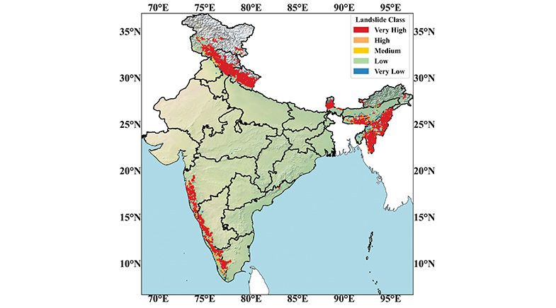
Collaborating with G.V. Ramana, Saharia and Sharma developed a high-resolution landslide susceptibility map of India using machine learning models (bit.ly/landslide-mapping). With a resolution of 100m, the map is perhaps the world’s most detailed large-scale landslide map. The only other map with a similar resolution is that of Georgia (in Europe). Most other large-area landslide maps have a resolution of 500 to 1,000m. The researchers have also developed an app.
India accounts for about 8% of global fatalities due to landslides; during 2001-21, landslides caused 847 deaths and displaced thousands. Yet, this geographical phenomenon was not given enough importance until the 2013 Kedarnath landslide and floods, after which the Geological Survey of India (GSI) began the National Landslide Susceptibility Mapping programme. The maps have a resolution of 1:50,000 and cover nearly 85% of the landslide-prone hilly areas.
The IIT team, however, wanted to create a nationwide map. Traditional vulnerability assessment for landslides considers a range of factors – the incline of the land, soil features, rainfall and anthropogenic land use, giving a fixed weightage to each. Since the nature of landslides in India varies with geography, the factors get different weightage in different areas. “We decided that instead of allocating weightage to the various factors ourselves, why not let the machine study all the data without prejudice and come up with its conclusions,” explained Sharma.
Researchers began by feeding data from the GSI-sourced inventory of 1.5 lakh landslides along with 500 landslides from global datasets. They also fed information obtained from public databases on 16 variables, such as the type of soil, the lay of the land, its erosivity factor, precipitation and data regarding rivers and roads in the country. Then, they trained the model to remove its “imbalance”. The model was trained to understand that the plains will not suffer landslides.
The map, called the India Landslide Susceptibility Map (ILSM), shows that 13.17% of the country is susceptible to landslides (more than previously believed) and that 4.75% is ‘very highly susceptible’. Sikkim has the largest land area (57.6%) that is landslide-prone, while outside of the Himalayas, Kerala is the most vulnerable State with over 14% of its land mass in the ‘very high susceptibility’ category.
Some areas in the Eastern Ghats, around Odisha, too, are susceptible – which previous studies had missed. Arunachal Pradesh has the largest susceptible area (31,845 sq km), which other models had missed because of paucity of data on landslides. “The model, however, was able to predict susceptibility by studying data from nearby States/regions,” said Sharma.
Madhavan Nair Rajeevan, Vice-Chancellor of Atria University in Bengaluru, who was not associated with this research, says that such a high-resolution map would help officials frame adaptation policies and mitigation efforts.
The IIT researchers’ ultimate goal is to develop a landslide Early Warning System (EWS) for all of India. Several other institutes are working on an EWS. Amrita University has one of the most advanced systems that’s been tried out in Kerala and installed in Sikkim. GSI has tested its EWS in Darjeeling and the Nilgiris. There is, however, no national-level landslide EWS.
An alert of even a few hours can save lives and mitigate the impact of a slip.


The NEW Science of Nutrition
A better understanding of how diet impacts health is leading to new ways of managing and treating lifestyle diseases.


Fields of green
Tech start-ups mine a spectrum of plant waste for profits and planetary good.

Innovation is the key
India's medical devices industry is navigating the path to self-reliance.

Have a
story idea?
Tell us.
Do you have a recent research paper or an idea for a science/technology-themed article that you'd like to tell us about?
GET IN TOUCH