Let's take a monsoon rain check
-
- from Shaastra :: vol 04 issue 05 :: Jun 2025
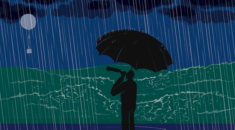
New research is poking holes in the old monsoon forecasting system. And it's raining ideas.
R.I. Sujith's interest in the monsoon took a turn after a chance meeting two years ago with Bhupendra Nath Goswami, one of India's foremost tropical meteorologists. Sujith, Professor of Aerospace Engineering at the Indian Institute of Technology (IIT) Madras, used complex dynamic networks to understand wide-ranging phenomena. He had a hunch that the complex network theory, which explores how connections drive the behaviour of large systems, could be employed to understand the Indian summer monsoon as a planetary-scale weather phenomenon. To test his ideas, he approached a few leading meteorologists in the country, but didn't get a positive response from them. He went back to his original research field, studying how sound creates instabilities in combustion, an area in which his pioneering work has led to the design of better jet engines and rockets.
In December 2023, Sujith, Institute Professor and D. Srinivasan Chair Professor of Aerospace Engineering, received an invitation from his colleague Sachin Gunthe to attend a talk by Goswami. There, Sujith discussed his ideas with Goswami, who, fired up by the thought, started a collaboration with the Centre of Excellence for studying Critical Transitions in Complex Systems (CTCS) at IIT Madras. "We thought this could give us a novel way to define the monsoon season more objectively and accurately," says Goswami, currently SERB Distinguished Fellow at Cotton University in Guwahati. The first research paper from the collaboration, in the preprint server Arxiv (bit.ly/monsoon-transition), has addressed several ambiguities about the onset of the Indian summer monsoon. "What we have found is really exciting," Goswami says.
Usually, the India Meteorological Department (IMD) declares the onset of monsoons by carefully observing rainfall activity at over 14 stations in Kerala and the southern Karnataka region. The onset is announced only when the quantum of rainfall received in these locations crosses a certain threshold. Forecasters also consider the wind speed, persistence, and depth of clouds when making an official onset announcement. However, such objective criteria are followed only for the onset over Kerala. For the rest of the country, meteorologists measure local precipitation and declare the onset when a percentile-based threshold is crossed. "This often leads to bogus onsets," says Sujith. "Getting local onsets accurately is very crucial for farmers. If the rains do not continue after the onset, birds will eat away sown seeds, and if there is too much rain, the seeds will decay."
The work, presented at the European Geosciences Union in April 2025 and at the American Meteorological Society in January 2025, applies the complex network theory to separate local-level onsets (caused by local atmospheric and weather conditions) from a large-scale onset, which is associated with the monsoon. In addition, the collaboration has provided insights into another big puzzle related to the monsoon: why the Northeast gets an abundance of rain before the onset of the monsoon over Kerala. Till now, the IMD has been branding them as pre-monsoon showers. Goswami, who was earlier Director of the Indian Institute of Tropical Meteorology (IITM) in Pune, has been arguing that this is indeed monsoon precipitation and the onset over the northeastern parts of India occurs much earlier than in Kerala. "This year, too, the monsoon hit the Northeast before May 1," he says. The IMD, however, announced the onset over the Northeast in the last week of May after it hit the Kerala coast.

The moisture-laden clouds brought in by the monsoon winds hit India from two flanks – either side of the monsoon trough. One comes over the Arabian Sea, and the other brings moisture picked up from the Bay of Bengal. Goswami, who has been keenly studying the monsoon over the northeastern region, believes the onset over the region occurs much earlier than in the southern peninsula, which happens around May 15. He thinks the monsoon season (in the Northeast) typically lasts about 155 days, almost a month more than the monsoon over central India (bit.ly/monsoon-NE).
The network theory, in this case, implies that local weather systems are evolving at small scales, and the rainfall in one cluster is not related or connected to another cluster. "When neighbouring points undergo onset, the size of the clusters increases, and this is a continuous growth phase. But when two clusters merge, there is an abrupt jump in growth in phase," says Shruti Tandon, a doctoral student of Sujith.
The scientists first identified clusters of local onsets in the Northeast and the southern peninsula. When simulated, they could see the clusters first emerging in the northeastern parts by the first week of May and slowly growing in size with more and more interconnections between the nodes as the monsoon advanced. A few days later, clusters were formed in the southern peninsula, with the first ones appearing in Kerala. By then, the connected network emerging from the Northeast had grown further in size by joining monsoon winds from the Myanmar region. "We suddenly see a phase transition happening there," says Gaurav Chopra, a postdoctoral student of Sujith and Assistant Professor of Applied Mechanics at IIT Delhi. Over the next few days, as the monsoon progressed northwards and westwards, those clusters emerging from southern peninsular and northeastern regions merged, assuming a gigantic planetary scale as the phenomenon eventually engulfed the entire subcontinent.
Sujith and Goswami have also been able to capture the retreating monsoon in a similar fashion. "And we could clearly see how the advancing monsoon was avoiding the rain shadow regions of Tamil Nadu, while the returning Northeast monsoon brought rains to these regions. This gave us a lot of confidence in our network model," says Sujith. To verify the network model, the scientists retrospectively ran it for every year from 1940 and found it captured advancing and retreating monsoons consistently well.
CHANGING RELATIONSHIPS
Monsoon forecasting in India started soon after 1876, when a series of cyclones and droughts led the British to establish the IMD. The drought of 1876 and 1877 led to crop failure and what is now known as the Great Famine, resulting in 5-9 million deaths. Henry Blanford, a Professor of Physics at Presidency College in Calcutta and the first head of the IMD, used the extent of Himalayan snow cover to give the first forecast for a deficient monsoon in 1885. Sir John Eliot, who succeeded Blanford at the IMD, brought in more parameters, such as local conditions and those over the oceans, in a bid to improve the forecasts. Although he could give a warning about storms, his forecasts sometimes were also embarrassing failures, leading the government to stop announcing them to the public.
The next big step in forecasting was taken by Sir Gilbert Walker, a prominent statistician and meteorologist, who brought statistical parameters into forecasting. Walker also discovered the oscillation of pressure between the Indian Ocean and the Pacific Ocean, now known as the southern oscillation, which is seen to have a big influence on the monsoon. The next significant measure came decades later when Vasant Gowarikar, the then Secretary of the Department of Science and Technology, introduced a statistical method with 16 variables in 1988. However, this model also had failures and was criticised by professional meteorologists.
The accuracy of forecasts has been improving in the past 15 years or so, with the adoption of dynamic models and, later, ensembles to issue forecasts. The ensemble forecasts, which integrated forecasts from global climate models, were started in 2021.
The accuracy of forecasts has been improving in the past 15 years or so, with the adoption of dynamic models and, later, ensemble forecasts.
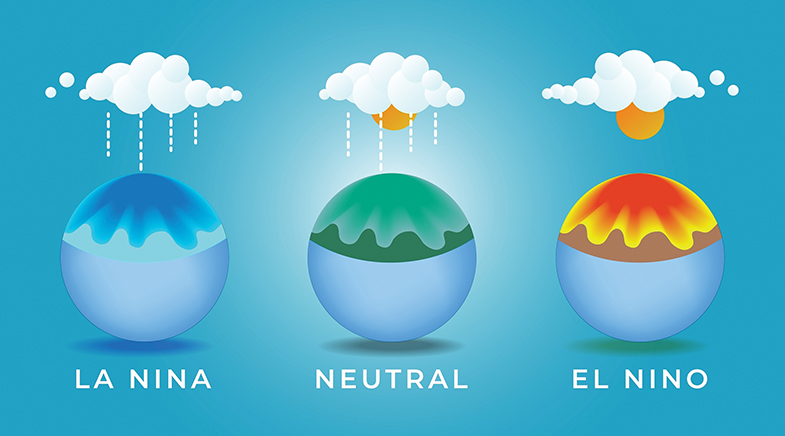
Through all these, meteorologists faced challenges in understanding the factors that drove the monsoons. For example, it has been known for a long time that the El Nino Southern Oscillation (ENSO) index influences the monsoon. So does the Indian Ocean Dipole (IOD), an oscillation of temperature in the Indian Ocean. However, monsoon rainfall does not always correlate well with these parameters. In recent times, global warming has introduced new complexities about how the parameters that influence the monsoon impact each other. Recent evidence suggests that a warming Earth is forcing changes in these relationships.
The most evident change is in the influence of ENSO on the monsoon. History suggests a cooler Pacific correlates with more rain over the Indian subcontinent. However, a warming Indian Ocean disturbs that relationship and reduces the rainfall during the monsoons. This means that during the La Niña years (cooler Pacific), India no longer gets as much rain as predicted by the models, as was the case before the 1980s. This shortfall is particularly pronounced in central India. "Our work has shown that if the Indian Ocean warms up by two to three degrees (Celsius), the rainfall over central India will reduce by 30-40%," says Rajagopalan Balaji, hydrologist and Professor at the University of Colorado Boulder, U.S. Rajagopalan's earlier work had shown a reduction of 6-8% in rain after the 1980s during the La Niña years. The Indian Ocean had warmed by 1.2° C over the last century. According to the Intergovernmental Panel on Climate Change, its temperature can increase by 1.7° C this century (over pre-industrial levels) with moderate emissions. The increase in temperature can be as much as 3.8° C if the emissions are uncontrolled.

Meanwhile, ENSO itself has been behaving in unusual ways. Traditionally, ENSO had two significant phenomena: warming (El Niño) and cooling (La Niña). During the pre-monsoon months this year, the eastern and western parts of the equatorial Pacific remained warm, while the central portions remained cool. The anomalous situation, however, subsided by the middle of May with the weakening of both warming and cooling, prompting meteorologists to hope that the impact of ENSO on the monsoon would be neutral this year. "El Niños and La Niñas keep coming, and most are predicted well. And yet, we need to understand how they are clustered into decades of highs and lows," says Raghu Murtugudde, former Professor at IIT Bombay's Centre for Climate Studies. Murtugudde has extensively studied the Indian monsoon's links with ENSO and the Indian Ocean weather.
A paper published in 2024 (bit.ly/ETM-Arindam) reported how researchers led by Arindam Chakraborty of the Centre for Atmospheric and Oceanic Sciences at the Bengaluru-based Indian Institute of Science had found a natural climate signal that influenced the emergence of sea temperature anomalies in the tropical Pacific. The group, of which Murtugudde was a part, found that ENSO's seasonal transition was modulated by sea-level pressure in the southern Pacific Ocean and associated surface wind changes. These wind anomalies were responsible for ocean warming in a specific area in the central and eastern tropical Pacific Ocean, whose surface temperature anomalies were responsible for the ENSO phenomenon. Called ENSO Transition Mode (ETM), this natural climate signal, the scientists found, prominently influences how El Niños or La Niñas transition from their peak winter states to the following summer state in decades. The team studied such multi-decadal variations for the last 50 years and saw most of the ENSO events panned out in the past. "We are now much closer to understanding these transitions with the discovery of ETM. We must now translate this into decadal predictions which have great implications for the decadal variability of the Indian monsoon," Murtugudde says.
Similarly, scientists studied in detail how climate change is interfering with two upper atmospheric winds: the tropical easterly jet stream, which lashes between latitudes of 10o and 20o North at altitudes of 12 kilometres, and the Asian jet, an upper troposphere westerly wind which passes over the north of India. Both influence the transport of moisture and monsoon circulation. When the monsoon starts, the subtropical westerly jet (Asian jet) migrates towards the north, giving space for low-level winds to penetrate over the Indian subcontinent, causing rain. A recent study (bit.ly/Chowdary) by Jasti S. Chowdary and others at the Pune-based IITM found that this westerly stream underwent variations between seasons. "Due to external forcings, this jet, which normally passes over 40o North, sometimes shifts southwards to 30o or 25o North. Such shifting can actually interfere with the easterly jet, which favours the monsoon. This weakens the easterly jet," says Chowdary.
While scientists knew that the westerly jet affected the monsoon, its mechanism of influence is being discovered now. Apart from this direct impact, the southward migration of the westerly jet influences the Indian monsoon indirectly, too. The anomaly also affects rains in other countries such as Japan, and this influences atmospheric circulation in the Pacific region. In the El Nino years, this also contributes to a reduction in the Indian monsoon rainfall, according to Chowdary.
HUMAN INTERFERENCE
While scientists are trying to figure out how the monsoon is changing due to climate change, they are also unravelling the influence on the monsoon of other human activities in the subcontinent when practised at a large scale. For example, widespread irrigation over North India is supposed to reduce the intensity of the monsoon, but recent research by Subimal Ghosh, Institute Chair Professor in the Department of Civil Engineering at IIT Bombay, and his team suggests that its influence is exaggerated, and the effect of irrigation shows up only in the later monsoon months (bit.ly/Ghosh-irrigation).
"The impact of irrigation on the monsoon is a bit exaggerated because of a wrong choice of models," says Ghosh. In Western countries, crops are typically grown in the summer, and global models adopted from the West consider irrigation happening during summer months. In India, crops are seldom grown in March, April and May, so there is no irrigation in summer. Using available irrigation and regional climate model simulations, the team showed that the irrigation effect on pre-monsoon heat stress, an important prerequisite for a good monsoon, is overestimated by nearly five times in these studies. The team found that irrigation increased relative humidity by a mere 2.5%.
On the other hand, Ghosh's group at IIT Bombay's Interdisciplinary Programme in Climate Studies found that flood irrigation for paddy cultivation in North India leads to a northwestward shift in monsoon rainfall in September, apart from exacerbating severe weather events over central India. In another piece of research through simulation, done jointly with researchers from the IITM in Pune, Ghosh's team found that a proposed project for interlinking rivers could adversely affect the Indian monsoon. The study, which appeared in September 2023 in Nature Communications (bit.ly/Ghosh-rivers), concluded that increased irrigation from water transferred from a surplus basin to another river basin could reduce September's mean rainfall by 12% in already water-stressed regions such as parts of Madhya Pradesh, Chhattisgarh, Odisha, Rajasthan and Gujarat. "When we did a causal analysis, we found that each basin's soil moisture affects the other basin's soil moisture through land-atmospheric feedback. Since the atmosphere has no boundary, unlike land, it starts affecting the rainfall in the other basin," says Ghosh.
During the La Niña years, India does not get as much rain as predicted by models. This shortfall is particularly pronounced in central India.
The northwestward shift of the Indian monsoon was captured by another study published by the New Delhi-based public policy research institution, the Council on Energy, Environment and Water (bit.ly/CEEW-Monsoon). The report, which examined rainfall patterns in over 4,500 tahsils (administrative subdivisions), showed that several tahsils in arid States such as Rajasthan, Gujarat and Maharashtra received 10-30% more monsoon rainfall during 2012-22 than in the three preceding decades (1982-2012). In contrast, 11% of the tahsils, mainly in the agriculturally important Indo-Gangetic Plains, witnessed a decrease of more than 10% monsoon rainfall in 2012-22 from 1982-2012. Nearly two-thirds of the tahsils saw an increase in the frequency of heavy rain in the last decade.
The multiple studies underline one factor: that the monsoon is changing more rapidly than ever before. "To understand this well, we really need to do much more work on ocean observations," says Madhavan Nair Rajeevan, former Secretary in the Ministry of Earth Sciences, who anchored India's efforts to understand the Indian monsoon in the past two decades. "Despite all the efforts in the past, we still don't know much about the Indian Ocean compared to the Atlantic or Pacific Ocean," he says.
See also:
Monsoon musings
Flashback, fast forward
Come rain or shine
It's raining solutions


Precision agriculture will feed the world, sustainably
Stop and smell the aromatic rice, made possible by cutting-edge technology.

Chipping away at dark energy
New datasets to be revealed in the coming years may challenge the accepted notions of dark energy.


An empowering eye-opener
A neat gadget seeks to help the visually impaired aim high.

Have a
story idea?
Tell us.
Do you have a recent research paper or an idea for a science/technology-themed article that you'd like to tell us about?
GET IN TOUCH